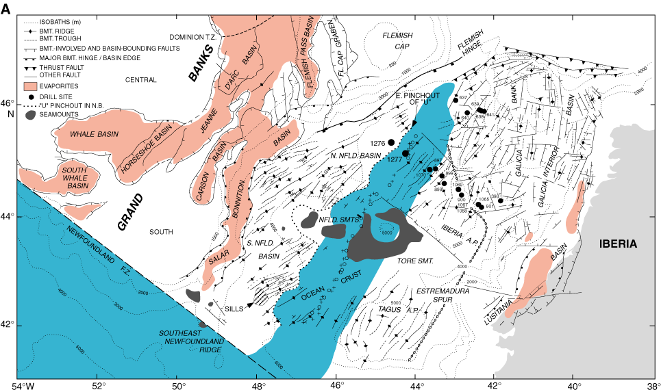
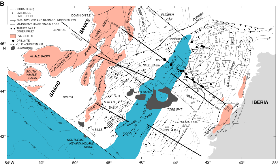
Figure F3. A. Reconstruction of the Newfoundland–Iberia rift to Anomaly M0 time (121 Ma), based on the reconstruction pole of Srivastava et al., 2000. Newfoundland plate is fixed in present geographic coordinates. Solid circles = locations of Sites 1276 and 1277 in the Newfoundland Basin plus DSDP and ODP drill sites on the conjugate Iberia margin. Tectonic and other data are compiled from numerous sources (structural data from the SCREECH survey [Fig. F5] are not included). The diamond pattern on the Iberia side shows the seaward limit of continental crust (poorly controlled south of the Iberia abyssal plain). Light red = evaporites in continental rift basins. Ocean crust (center, blue) is presumed to have formed beginning near Anomaly M3. A south-to-north zipperlike opening would account for the observed splayed tectonic trends between the two margins and the northward-narrowing zone of ocean crust. On the Newfoundland side, the U reflection extends throughout the Newfoundland Basin and pinches out seaward near Anomaly M3. BMT. = basement, SMT(S). = seamount(s). NFLD. = Newfoundland, A.P. = abyssal plain, FL. = Flemish, N.B. = Newfoundland Basin. F.Z. = fracture zone, T.Z. = transition zone. B. Anomaly M0 reconstruction as in A, with locations of reflection profiles. Solid lines show locations of profiles in Figure F4,
and dotted lines show positions of other SCREECH transects not illustrated here (see Fig. F5).