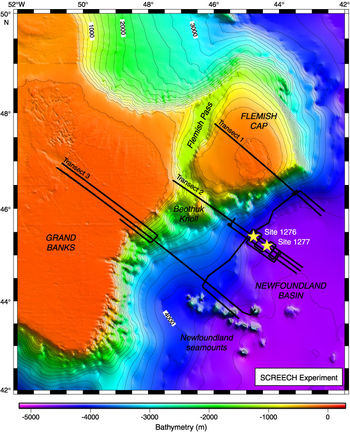
Figure F1. Bathymetric map of the Newfoundland margin extracted from the GEBCO Digital Atlas published by the British Oceanographic Data Centre on behalf of Intergovernmental Oceanographic Commission and the International Hydrographic Organization (British Oceanographic Data Centre, 2003). Contour interval = 200 m. Black lines = tracks of the SCREECH survey, yellow stars = locations of Sites 1276 and 1277. Coincident MCS, wide-angle seismic reflection/refraction, magnetic, gravity, and multibeam bathymetric data were acquired on transects 1, 2, and 3. MCS, magnetic, gravity, and multibeam bathymetric data were acquired on other lines.