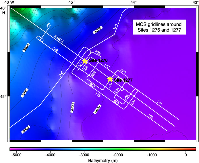
Figure F2. Bathymetric map of the area around the seaward part of SCREECH transect 2 from the GEBCO Digital Atlas (British Oceanographic Data Centre, 2003). Contour interval = 200 m. MCS lines are indicated with white lines and labeled by line number, and they are shown in Figures F3
and F4. Yellow stars = locations of Sites 1276 and 1277.