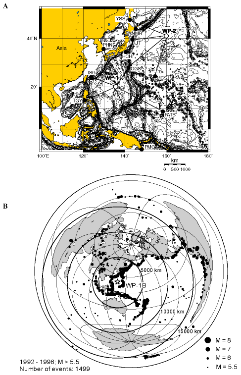
Figure 1. A. Location map of seismic station coverage in the northwest Pacific. Stations needed in the oceans worldwide. At least five major plates with consuming boundaries interact in the northwest Pacific, causing subduction, back-arc opening, slab collisions, terrane accretion, and island arc development. Solid circles indicate land seismic stations, whereas open circles are current and proposed seafloor borehole observatories. Note that a few borehole stations effectively complement and expand the existing network. YSS = Yuzhno Sakhalinsk, Russia, 46.9583°N, 142.7610°E; NMR = Nemuro, Japan, 36.1525°N, 145.7430°E; PHN = Pohang, Korea, 36.03°N, 129.36°E; HCH = Hachijo-shima, Japan, Reserved; OGS = Chichi-jima, Japan, 27.0570°N, 142.2030°; MCSJ = Minami-tori-shima, Japan, 24.290°N, 153.978°E; ISG = Ishigaki, Japan, 24.3793°N, 124.2347°E; PATS = Ponsei, Micronesia, 6.8367°N, 158.3125°E; PMG = Port Moresby, Papua New Guinea, -9.41°N, 147.16°E; TGY = Tagaytay, Philippines, 14.10°N, 120.94°E. B. Location of proposed Site WP-1B in relation to global seismicity. M = magnitude.