
Leg 204 (used to be Leg 199 before 24 August 2000)
Drilling Hydrates on Hydrate Ridge, Offshore Oregon
Gas hydrates in sediments are a matter of considerable interest because of their potential as seals over hydrocarbon reservoirs, their significance as a possible resource, their role in slope stability and their potential for causing catastrophic changes in atmospheric methane and climate change.
Seismic data across Hydrate Ridge, off Oregon, show systematic variations in stratigraphic and reflectivity of the Bottom Simulating Reflectors (BSRs) that appear to be indicative of the impact of tectonic activity on the evolution of the hydrate/gas system of the Oregon margin. These patterns are especially well defined on the southern part of Hydrate Ridge, where grab sampling in 1996 revealed the presence of massive hydrate deposits near the seafloor.
Leg 204 will drill three holes, 400-700 m in depth, accompanied by comprehensive biological and geochemical sampling and by a suite of in situ measurements, to address the following specific objectives:
-
1) Compare the source region for gas and the physical and chemical mechanisms of hydrate formation in two distinctly different sedimentary and tectonic environments: (a) the older sediments of the accretionary complex, where massive hydrates and associated authigenic carbonate are found near the seafloor and methane may originate in underthrust sediments, and (b) the younger, well-stratified sediments of the adjacent, rapidly-filling slope basin, where seismic reflectivity indicates deeply buried hydrate and/or free gas but no significant hydrate and/or carbonate accumulations near the seafloor. Here the gas source is likely to be more local.
2) Calibrate estimates of hydrate volumes and underlying free gas content determined with geophysical remote sensing techniques. A better understanding of these properties is needed to map hydrate distribution regionally between drill sites, permitting us to evaluate the future economic potential of gas hydrates in subduction zone environments.
3) Test, using geochemical tracers, physical properties measurements, and microstructural analysis, whether variations in BSR and subBSR reflectivity observed in seismic data result from tectonically induced hydrate destabilization, as inferred from seismic reflection data.
4) Develop an understanding of the geochemical effects of hydrate formation in order to identify paleo-proxies for methane release that can be used to integrate the geologic data into climate models and understand the possible role of massive, catastrophic hydrate destabilization on global change.
5) Determine the porosity and shear strength of hydrated and underlying sediments in order to evaluate the relationship between hydrates, fluid flow and slope stability.
6) Quantify the distribution of methanogenic and methanotropic bacteria in the sediments in order to evaluate their contribution to hydrate formation and destruction and related sediment diagenesis.
Drilling Plan
Three 400-700 m deep drill holes are proposed along with an extensive downhole measurement program. These activities are to: 1) calibrate estimates of hydrate and free gas volumes with remote sensing techniques, 2) measure in situ physical and seismic properties and correlate variations with the BSR and sub-BSR reflectivity, and 3) estimate the porosity and shear strength of hydrate-bearing and underlying sediments to evaluate slope stability and fluid flow effects.
Wireline logging tools, VSP, pressure core sampling, and LWD are proposed during a mini-leg to determine the formation mechanisms of the shallow, massive Hydrate Ridge. State-of-the-art LWD tools are to be used to measure high-quality porosity and density (ADN). Standard wireline logging tools should also be deployed. The laterolog (DLL) may only be needed in the unlikely event that the bulk resistivity is extremely high. Previously measured resistivities at nearby Site 889 and Site 890 were <1.0 ohm and <2.5 ohm, respectively, and therefore the standard induction resistivity tool (DITE) should provide adequate results. Both P&S velocity measurements are required to achieve the proposed objectives and the standard DSI tool should be used. The 3-component VSP tool is also needed to record the proposed offset VSP experiments.
| Leg | Prop # | Description | Site Prop | Lat. Prop | Long. Prop | Water Depth Prop. | Total Depth Prop |
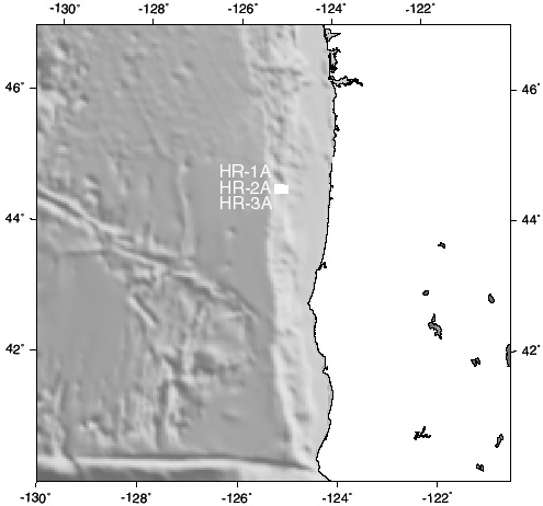
| 204 | 546 | Hydrate Ridge | HR-1A | 44°35.2'N | 125°07.0'W | 900 | 700 |
| HR-2A | 44°35.15'N | 125°03.85'W | 1220 | 600 | |||
| HR-3A | 44°35.25'N | 125°09.95'W | 1000 | 600 |
Staff Scientist: Frank Rack
Operations Schedule | Back to FY 01-02 Abstracts
ODP |
Search |
Database |
Drilling |
Publications |
Science |
Cruise Info |
Public Info |
Admin |
Computing |
Staff |
Mirrors
Send comments to webmaster@odpemail
.tamu.edu.
Modified on Wednesday, 06-Mar-2002 10:28:23 CST.