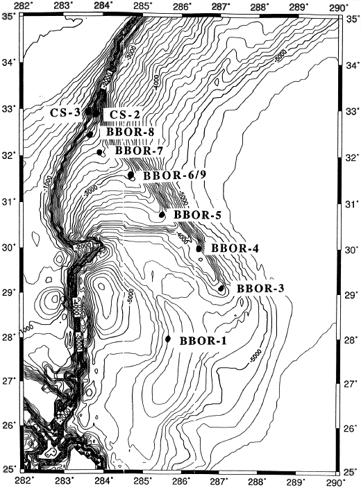
Figure 172-2. Map showing the location of the Carolina Slope (CS) and Blake-Bahama Outer Ridge (BBOR) sites. These sites form a depth transect from about 1200 to 4800 m water depths. Sites BBOR-6 and BBOR-9 (~2 km apart) span an abrupt change in terrigenous sediment flux, and Site BBOR-1/2 will sample across a mud wave. Note: alternate sites are not shown because they are near the primary sites.