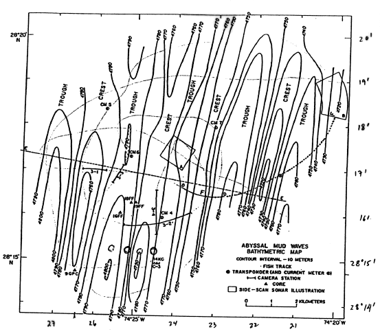
Figure 172-8. Map of mud wave field on northwestern flank of Bahama Outer Ridge, based on Scripps Deep tow with 4 kHz profiler, sidescan sonar, etc. (Flood, 1978). Note location of core GPC-9 in southwest corner. We will core flanks of a wave from a shallower field, to the south of this figure.
To 172 Proposed Site Information