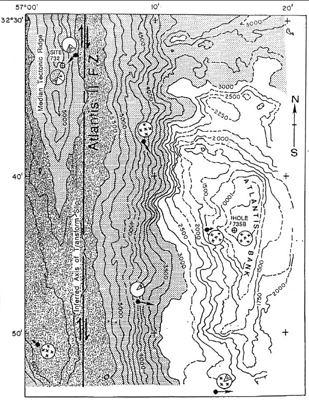
Figure 176-1. Hand-contoured bathymetric map of the eastern transverse ridge, showing the location of Site 732 and Hole 735B. SeaBeam tracks hand-shifted by eye to eliminate conflicts in the data. Solid lines indicate actual data, while hatched lines show inferred contours. Contour interval is 250 m. Solid dots and arrows indicate the starting point and approximate track of dredge hauls. Filled circles indicate the approximate proportions of rock types recovered in each dredge - white = altered gabbro; + = gabbro; V = basalt and diabase, stippled = greenstone.