Technical Note 20/5
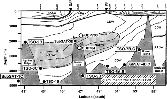
Figure 2. Schematic representation of the vertical distribution of potential temperature on a transect in the eastern Atlantic sector of the Southern Ocean (from Agulhas Ridge to Bouvet Island) relative to the proposed Leg 177 sites. The ratio numbers at the top of the figure indicate the hydrographic station used to contour the potential temperature. PF = Polar Front. SAF = SubAntarctic Front.
To Figure 177-3
Table of Contents
Publications Home
ODP Home