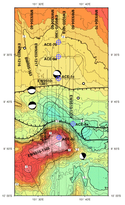
Figure 3. Map showing the location of the proposed drill sites (ACE-1c, 3c, 7a, 8a, and 9a) and multichannel seismic track data plotted on a base map with 100 m bathymetric contours. Black circles are relocated epicenters which, together with the focal mechanisms, are from Abers (in press). The western limit of the Woodlark spreading system is marked by the closed black line, the major normal faults by the ticked lines.