Leg 183
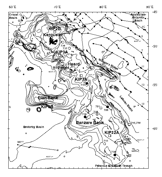
Figure 2. Bathymetric map of the Kerguelen Plateau with SEIR magnetic
isochrons indicated on the eastern flank (from Schlich et al., 1987).
Previous ODP drill sites that recovered igneous basement are indicated by
filled circles. The proposed drill sites (KIP) for Leg 183 are indicated by
open squares.
To 183 Figure 3
Table of Contents
ODP Publications
ODP Homepage