The first part of this paper summarizes the seismic stratigraphy recognized in the Ocean Drilling Program (ODP) Leg 149 area and its relationship to lithostratigraphic and biostratigraphic data obtained at Sites 897-900 and Deep Sea Drilling Project (DSDP) Site 398. The second part presents three approaches to understanding the tectonic history of the area: (1) seismic stratigraphic evidence for the timing of rifting, (2) subsidence at individual Leg 149 sites, and (3) total tectonic subsidence (TTS) based on digitized versions of the interpreted seismic lines.
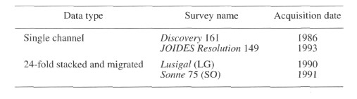
Figure 1 shows the location of the seismic lines interpreted during this study and the positions of DSDP Site 398 and ODP Sites 897-901. Data from the following seismic surveys were used:
A variety of problems was faced when interpreting the data. Differing acquisition and processing methods (including the fact that the Lusigal and Sonne lines were not processed in the same way) result in differing reflection characteristics (i.e., seismic facies) displayed by the same stratigraphic intervals on adjacent lines. Correlation across basement highs is problematic for two reasons. First, onlap onto the highs made it impossible to correlate individual reflections or reflection packages from one low to the next along the same line unless they could be tied together along other parts of the seismic grid; given the relatively wide spacing of the lines (Fig. 1), this was rarely possible. Second, compressional structures (folds and faults) above some basement highs made it difficult to trace reflections over and across them, although it was generally possible to trace them around other parts of the grid.
At the start of the study, no attempt was made to recognize the seismic stratigraphic units defined in adjacent areas by earlier workers (Groupe Galice, 1979; Mauffret and Montadert, 1988). The bases of six reflection packages were identified using a combination of reflection terminations and/or reflection characteristics. In areas where the bases of seismic units could not be recognized using such criteria, they were located by tracing the boundaries around the seismic grid from the parts of profiles where the criteria for boundary recognition are clear.
The seismostratigraphic boundaries we recognized were equated to the lithostratigraphy and biostratigraphy determined at Sites 897-900 by converting depths in two-way traveltime to depths in the holes using the sonobuoy-based velocity structure of Whitmarsh et al. (1990b). These data provided very accurate (±20 m) depth estimates to basement during Leg 149.
The deepest borehole penetration (750 m) of the layered reflection sequence was achieved at Site 900, equivalent to 800 ms two-way traveltime (TWT). This is barely one-third of the maximum depth in time of 2200 ms TWT observed in the study area and probably represents only one-quarter of the maximum thickness of sediments overlying acoustic basement (which is probably greater than 2.7 km). Therefore, biostratigraphic and lithostratigraphic data obtained during Leg 149 only illuminate the age and sedimentary character of seismic stratigraphic Units 1-3 and the upper part of Unit 4. Comparisons to the sequence drilled at DSDP Site 398 enable suggestions to be made concerning the age and likely lithologic character of sediments equivalent to the remainder of Unit 4 and to Units 5 and 6.
The foldout sheet enclosed in the back pocket of this volume includes a map (Fig. 2) that shows the location of folds described by Masson et al. (1994) and line drawings of our interpretation of profiles LG04, LG12, SO16-18, and SO20. Figure 1 of Beslier (this volume), a reproduction of almost the entire length of profile LG12, also can be found as oversized PDF file (Fig. 3).
![]()