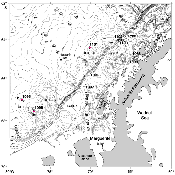
Figure F1. Location map of ODP Sites 1095, 1096, and 1101 (shaded), together with all the other sites drilled during ODP Leg 178 (bathymetry after Rebesco et al., 1998). Short lines labeled a, b, and c indicate the approximate locations of MCS profiles as follows: a = Figures F4 and F8; b = Figures F12 and F14; c = Figure F16. No seismic profiles are shown across Site 1101.
![]()