![]()
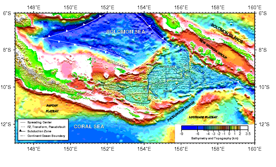
Figure F1. A shaded topographic image of the Woodlark Basin region showing the major physiographic features and active plate boundaries. The tectonic elements defined in the legend are from Goodliffe (1998) and Taylor et al., (in press) and are reproduced on Figures F3, F4, F5, F6, and F7. E = Egum Atoll, G = Goodenough Island, GB = Goodenough Basin, F = Fergusson Island, L = Mount Lamington, M = Misima Island, MB = Milne Bay, MS = Moresby Seamount, MT = Moresby transform fault, N = Normanby Island, R = Rossel Island, SD = Suckling-Daymon massif, ST = Simbo transform fault, T = Tagula Island, TR = Trobriand Islands, V = Mount Victory, and W = Woodlark Island.
![]()