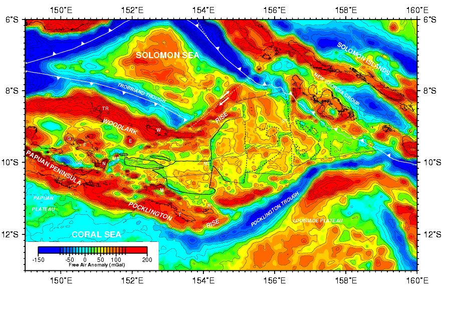
Figure F6. Free-air gravity anomaly map compiled from shipboard, land, and satellite altimetry-derived values. Contour interval is 20 mGal. See Figure F1 for an explanation of tectonic symbols and place abbreviations.