![]()
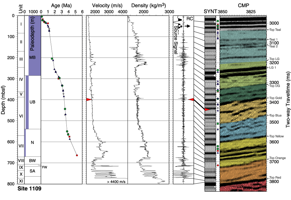
Figure F4. Logging and coring results (Shipboard Scientific Party, 1999b), check shot-corrected depth conversion, and correlation via synthetic seismogram to MCS data in the vicinity of Site 1109. Refer to the caption of Figure F3 for a detailed explanation. In the second panel, BW = brackish water, FW = freshwater. Between panels eight and nine, the points from panel three have been projected from depth to time (and shifted down by 22 ms to account for the lag between the first break and the center of the first peak in the source signal) to enable direct correlation with the synthetic seismogram and the MCS data in panel nine. Seventy-five CMPs (937.5 m) extending from Site 1109 (at CMP 3850) to the north are displayed in panel nine.
![]()