![]() Figures F1-F20
Figures F1-F20
![]() Figures
F21-F40
Figures
F21-F40
![]() Figures
F41-F60
Figures
F41-F60
![]() Figures
F61- F80
Figures
F61- F80
![]() Figures
F81-F85
Figures
F81-F85
![]() Tables
T1-T21
Tables
T1-T21
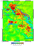
F1. Satellite-derived free-air gravity map of the Kerguelen Plateau.
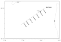
F2. Location of Site 1138 and site-survey data.
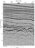
F3. Rig Seismic RS179/101 multichannel seismic profile across Site 1138.
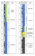
F4. Composite stratigraphic section for Site 1138.
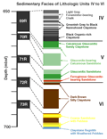
F5. Schematic diagram showing sediment facies recovered in cores from lithologic Units IV through VI.
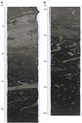
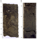
F6. Dark gray to black nannofossil claystone intervals and organically rich claystone interval.
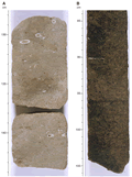
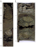
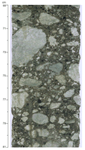
F7. Examples of variable lithologies in Unit V.
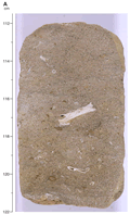
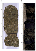
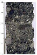
F8. Rusty brown glauconite-bearing calcareous sandstone.
F9. Examples of sediments in Unit VI.
F10. Sandstone beds of variegated color and lithology in Unit VI.
F11. Highly weathered regolith of variegated colors at the base of Unit VI.
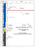
F12. Site 1138 age-depth plot.
F13. Stratigraphic section of the volcaniclastic succession in basement Unit 2.
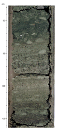
F14. Close-up photograph of interval 183-1138A-78R-4, 69-81 cm.
F15. Close-up photograph of interval 183-1138A-77R-2, 136-146 cm.
F16. Close-up photograph of interval 183-1138A-78R-4, 145-151 cm.
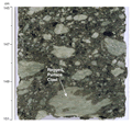
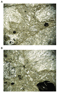
F17. Photomicrographs showing the nature of the pumiceous matrix in the pumice-lithic breccia and lithic breccia units.
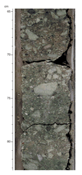
F18. Close-up photograph of interval 183-1138A-76R-2, 88-106 cm.
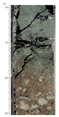
F19. Close-up photograph of interval 183-1138A-76R-2, 65-83 cm.
F20. Close-up photograph of interval 183-1138A-77R-1, 10-25 cm.
![]() Figures F1-F20
Figures F1-F20
![]() Figures
F21-F40
Figures
F21-F40
![]() Figures
F41-F60
Figures
F41-F60
![]() Figures
F61- F80
Figures
F61- F80
![]() Figures
F81-F85
Figures
F81-F85
![]() Tables
T1-T21
Tables
T1-T21