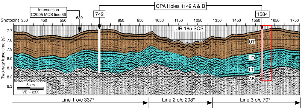
Figure F4. JOIDES Resolution (JR) single-channel seismic (SCS) water gun lines 1, 2, and 3. The bold white line at Shotpoints 742 and 1584 indicates the location and interval cored in Holes 1149A and 1149B. A box encloses the portion of SCS line 3 displayed in Figure F2. Colors mark regionally identified seismic facies; light brown corresponds to the upper transparent layer (UT) and light blue encompasses the upper opaque (UO) and lower transparent (LT) layers lying above acoustic basement (AB). Seismic data were processed and displayed with the following parameters: seafloor mute, band-pass filter = 25-100 Hz, three-trace mix, plot every third trace, 500-ms AGC, and vertical exaggeration (VE) = 23x at the seafloor. MCS = multichannel seismic, CPA = closest point of approach, o/c = on course.