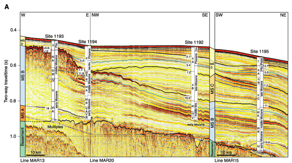
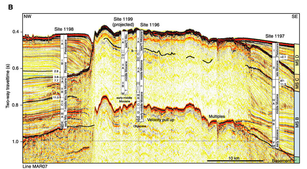
Figure F13.
Seismic correlation between Leg 194 sites (see Fig. F2
for location profiles). A.
Northern transect along seismic lines MAR13, MAR20, and MAR15 linking
Sites 1193, 1194, 1192, and 1195. B. Southern transect along seismic line
MAR07 linking Sites 1198, 1199, 1196, and 1197. The position of Site 1199 was
projected into the seismic section parallel to the northwestern SMP margin.
Roman numbers in left columns are lithologic unit boundaries. They do not
correlate from site to site, as unit definition was based upon shipboard
sedimentologic description of the drilled cores. Right columns indicate epoch
boundaries defined with the shipboard age models. Numbers on the seismic section
next to the sites indicate the age of seismic sequence boundaries, derived from
time-depth conversion and shipboard age models. MS = megasequence. (This figure
is also part of oversized
Figure F10A.)