![]() Figures F1-F30
Figures F1-F30
![]() Table
T1
Table
T1
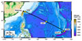
F1. Location map showing sites drilled during Leg 195.
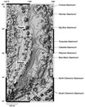
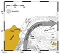
F2. Bathymetric map of the southern Mariana forearc.
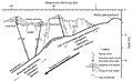
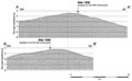
F3. Schematic cross section through the Mariana system.
F4. HMR-1 side-scan imagery of South Chamorro Seamount.
F5. Multichannel seismic reflection profiles over South Chamorro Seamount.
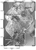
F6. Location of Holes 1200A-1200E on the summit knoll of South Chamorro Seamount.
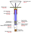
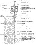
F7. Casing configuration for the geochemical observatory.
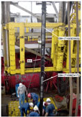
F8. CORK configuration in Hole 1200C.
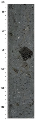
F9. Serpentine mud breccia from South Chamorro Seamount.
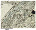
F10. Glaucophane schist in serpentine mud.
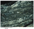
F11. Tremolite-rich chlorite schist in serpentine mud.
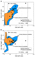
F12. Composition diagrams for Mariana forearc peridotites showing degrees of partial melting.
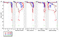
F13. Pore water composition vs. depth curves.
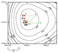
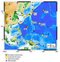
F14. Location of seismic station coverage in the northwest Pacific region.
F15. Location map showing DSDP and ODP sites in the Philippine Sea.
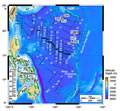
F16. Reflection line OT97 showing the location of Site 1201.
F17. Borehole seismometer instrument package.
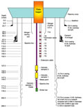
F18. Configuration of reentry cone, casing, and ION seismic observatory components.
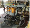
F19. ROV landing platform.
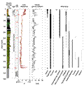
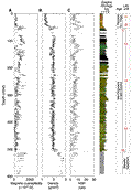
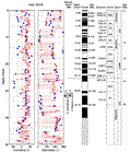
F20. Lithology, color, natural gamma count, and mineralogy vs. depth and age.
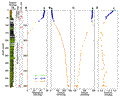
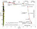
F21. Laboratory multisensor track measurements.
F22. Logging results from Hole 1201D.
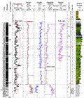
F23. Pore water Mg, Ca, Na, and alkalinity concentrations vs. depth.
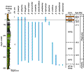
F24. Nannofossil ranges at Site 1201.
F25. Magnetic inclination and declination record in pelagic sediments.
F26. Sedimentation rates at Site 1201.
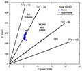
F27. V vs. Ti tectonic discrimination diagram.
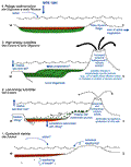
F28. Geological interpretation of the sediment and basement section.
F29. Location of Site 1202 in the Okinawa Trough.
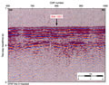
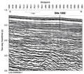
F30. North-south seismic profile EW95091 at Site 1202.
T1. Leg 195 coring summary.