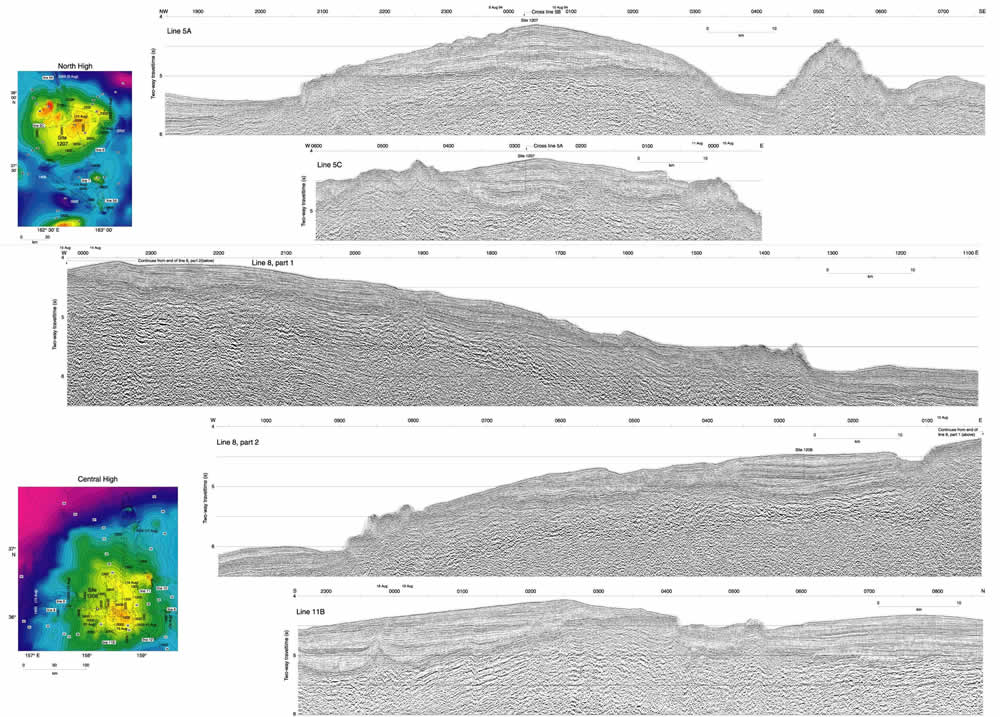
Figure F7. Top: Seismic lines (5A and 5C) collected over the North High showing the location of Site 1207. Bathymetric map displays the location of all North High seismic lines collected; bold white lines show the location of seismic lines 5A and 5C. Seismic lines not shown in this figure (5B, 6, and 7) are shown in Figure F10. Bottom: Seismic lines (8 and 11B) collected over the Central High showing the location of Site 1208. Bathymetric map displays the locations of all Central High seismic lines collected; bold white lines show locations of seismic lines 8 and 11B. Seismic profiles not shown in this figure (10, 11A, 11C, and 12) are shown in Figures F11,
F12,
and F13.
Click
here or on image to see larger
image. This figure is available in an oversized
format.