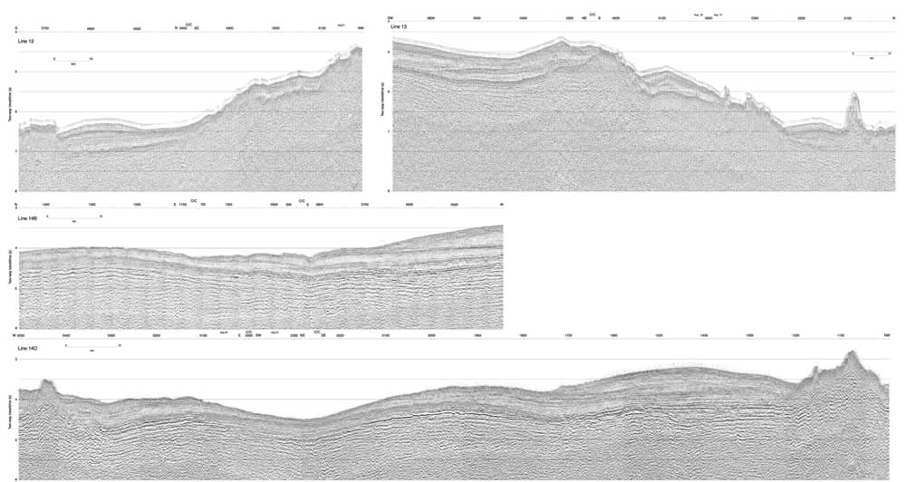
Figure F13. Top: Seismic lines 12 and 13 collected during the transit from the Central High to the South High. The locations of seismic lines are shown in Figure F1. Middle and bottom: Seismic lines 14B and 14C collected over the South High. The locations of seismic lines are shown in Figure F2. C/C = change in ship's heading.
Click
here or on image to see larger
image. This figure is available in an oversized
format.