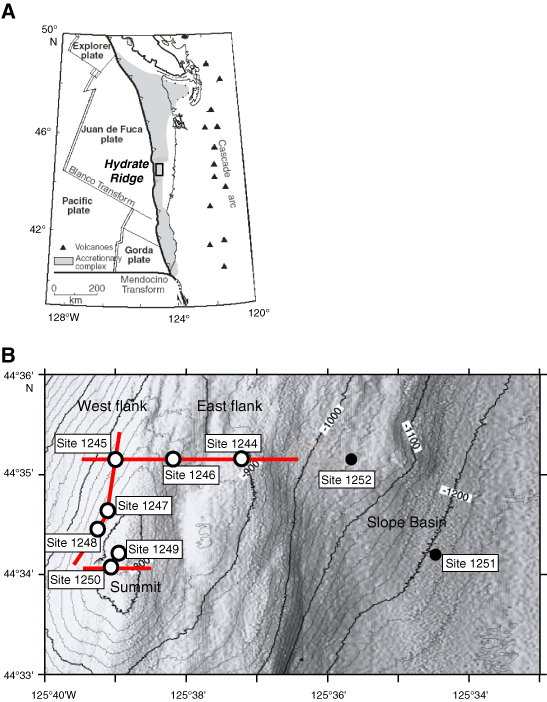
Figure F1. A. Plate tectonic setting of the Cascadia accretionary margin. Black outlined box shows location of Hydrate Ridge. B. Detailed bathymetric map (20-m contour) showing the location of Leg 204 drill sites on southern Hydrate Ridge. Open circles = sites presented in this data report, red lines = location of seismic profiles presented in Figure F2 (Tréhu, Bohrmann, Rack, Torres, et al., 2003).