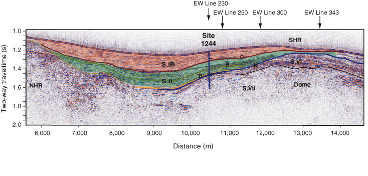
Figure F5. Seismic Line NS3 showing thinning of Units S.I and S.II toward the northern and southern summits of Hydrate Ridge. The location of this regional 2-D seismic profile is shown in Figure F1C. NHR = northern Hydrate Ridge. SHR = southern Hydrate Ridge.