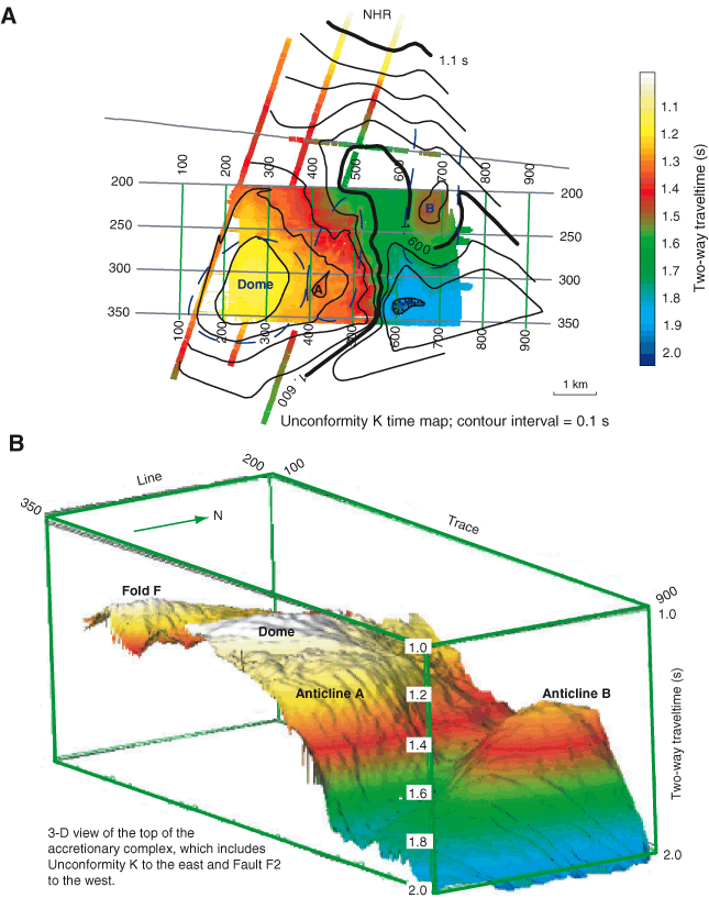
Figure F7. A. Time map to Unconformity K, which marks the boundary between seismic Units S.VI and S.VII and younger overlying strata. This map has been extended north of the 3-D survey using the 2-D profiles. It shows the circular nature of the Dome uplift and Anticlines A and B. NHR = northern Hydrate Ridge. B. 3-D perspective of the top of the accretionary complex. East of southern Hydrate Ridge, this surface is defined by Unconformity K; to the west, it is defined by Fold F and Fault F2 (Fig. F6A). The northward plunge of Fold F and the southward plunge of Anticline B are apparent.