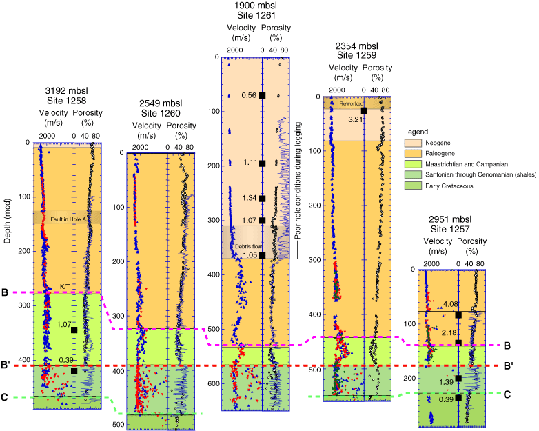
Figure F3. Location and overconsolidation ratio (OCR) of samples used in this study. Sample locations are denoted by a black box, with the OCR value offset to the left (OCR from Table T1). Downhole velocity and porosity profiles are also presented. Velocity measurements are uncorrected for in situ temperature and pressure. Colors (blue, red, and green) indicate measurements from Holes A, B, and C, respectively. Discrete measurements of porosity (open circles) are shown alongside downhole wireline porosity logs. Stratigraphic boundaries corresponding to regional seismic markers B, B´, and C are indicated with dotted lines (see Fig. F5 for description of seismic markers). Figure adapted from Shipboard Scientific Party (2004b). mbsl = meters below sea level.