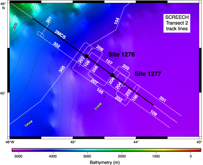
Figure F6. Track-line map of the SCREECH survey (Ewing cruise 00-07) along transect 2, conjugate to the ODP Leg 149/173 drilling transect on the Iberia margin (see also Fig. F3B). Locations of Leg 210 Sites 1276 and 1277 are indicated. The black section of the track line shows the section of reflection profile 2MCS illustrated in Figure F8. The complete set of multichannel seismic data is presented in
Shillington et al., this volume. Bathymetric contour interval = 200 m.