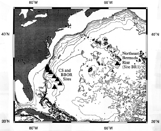
Figure 172-1. Map of the western North Atlantic Ocean showing the locations of proposed Leg 172 sites on the northeast Bermuda Rise (Site BR-1), the Carolina Slope (CS), and Blake-Bahama Outer Ridge (BBOR). Note: Site BR-1A (alternate to BR-1) is very near Site BR-1 and is not shown.