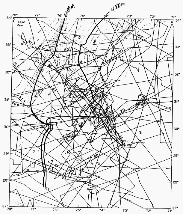
Figure 172-7. Coverage by single and multichannel seismic lines 79-90 at Blake-Bahama Outer Ridge (Markl and Bryan, 1983). Approximate location of 2000 and 4000 m contours is drawn for reference. USGS line BT-1 and LDGO line 87 run down the axis of the Blake Outer Ridge. BT & FC=USGS lines, UT=Univ. of Texas lines.
To Figure 172-8
To 172 Proposed Site Information