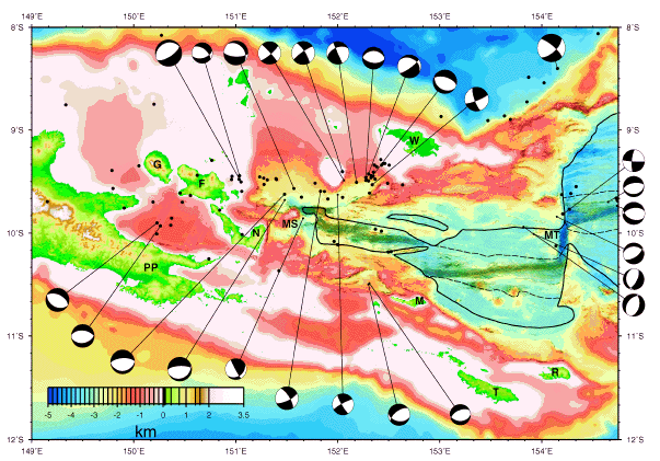
Figure 2. HAWAII MR1 bathymetric texture and acoustic imagery. Relocated epicenters (black circles) and earthquake focal mechanisms are from Abers (in press). PP = Papuan Peninsula, G = Goodenough Island, F = Fergusson Island, N = Normanby Island, R = Rossel Island, T = Tagula Island, MS = Moresby Seamount, MT = Moresby transform fault, M = Misima Island, W = Woodlark Island. The solid line is the landward boundary of oceanic crust, and the dashed line marks the boundary of crust formed during the Brunhes Chron.