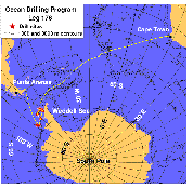
F1. General map of Leg 178 with ship track.
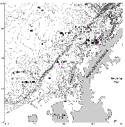
F2. Bathymetric chart of the Antarctic Peninsula Pacific margin.
F3. Schematic figure of tectonic and glacial elements of Antarctic Peninsula margin.
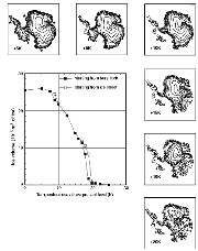
F4. Graph and maps of ice-sheet size and location at mean sea-level temperatures.
F5. Sequence model of deposition on shelf and slope through a glacial cycle.
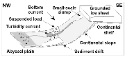
F6. Schematic drawing of the processes active during glacial half-cycles.
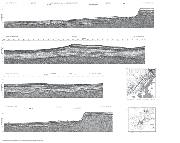
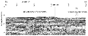
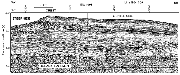
F7. Part of MCS reflection profile I95-137 across Site 1095.
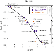
F8. Depth-age profile determined from geomagnetic reversals and diatom and radiolarian datums.

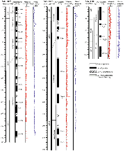
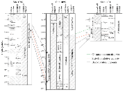
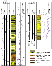
F9. Lithostratigraphic, magnetostratigraphic, and biostratigraphic findings at sediment drift sites.
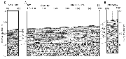
F10. Part of MCS reflection profile I95-130A across Site 1096.
F11. Depth-age relationship for Site 1096 based on geomagnetic reversals and diatom and radiolarian datums.
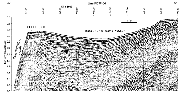
F12. Part of MCS reflection profile IT92-114 across Site 1101; seismic stratigraphic record at proposed sites APRIS-05A and 06A.
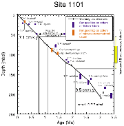
F13. Depth-age profile determined from geomagnetic reversals and diatom and calcareous nannofossil datums, Site 1101.
F14. Biostratigraphic findings in continental rise sites.
F15. Location of Site 1097 on single-channel seismic reflection profile PD88-04.
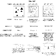
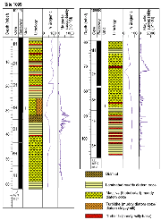
F16. Summary of facies recovered at Site 1097.
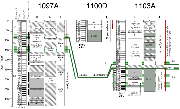
F17. Continental shelf transect (Sites 1100, 1102, and 1103).
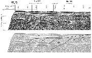
F18. Simplified lithostratigraphy at Site 1103.
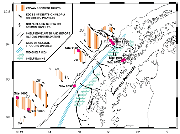
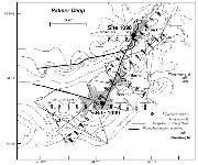
F19. Bathymetry and location of site-survey seismic reflection profiles on Palmer Deep.
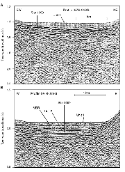
F20. GI air gun seismic profile I97H-228G across Palmer Deep sites, Basins I and III.
F21. Lithostratigraphic columns for Site 1098.
F22. Lithostratigraphic columns for Site 1099.
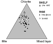
F23. Relative abundances of chlorite, illite, and mixed-layer clays from Sites 1095, 1096, 1097, and 1101.
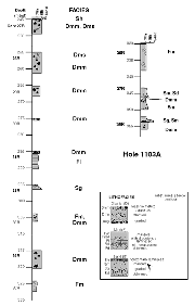
F24. Downhole logs from Hole 1103A with core measurements.
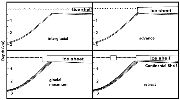
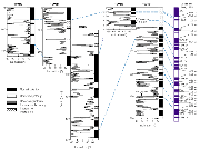
F25. Biostratigraphic summary of shelf sites with seismic correlation.
F26. Magnetostratigraphic summary for continental rise sites.
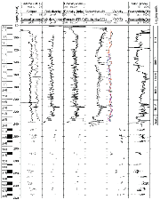
T1. Leg 178 coring summary.
M1. QuickTime video (shelf seabed).
AF1. Seismic reflection profiles crossing sites drilled during Leg 178.