![]() Figures F1-F20
Figures F1-F20
![]() Figures
F21-F40
Figures
F21-F40
![]() Figures
F41-F60
Figures
F41-F60
![]() Figures
F61-F80
Figures
F61-F80
![]() Figures
F81-F100
Figures
F81-F100
![]() Tables
T1-T19
Tables
T1-T19
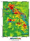
F1. Satellite-derived free-air gravity map of the Kerguelen Plateau.
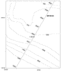
F2. Location of Site 1139 and site-survey data.
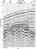
F3. Marion Dufresne MD109-05 multichannel seismic profile across Site 1139.
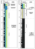
F4. Composite stratigraphic section.
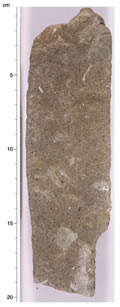
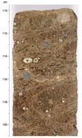
F5. Examples of foraminifer nannofossil chalk in Unit III.
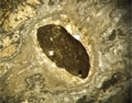
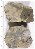
F6. Sandy packstone of Unit IV.
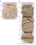
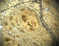
F7. Examples of grainstones and packstones of Unit V.
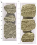
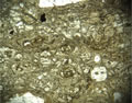
F8. Examples of cross-stratified grainstones of Unit V.
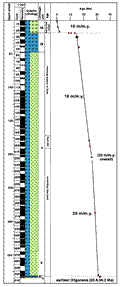
F9. Age-depth plot.
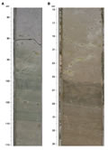
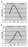
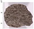
F10. Basement Subunit 1A.
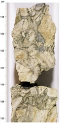
F11. Close-up photograph of interval 183-1139A-52R-1, 117-130 cm.
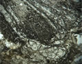
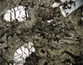
F12. Photomicrograph showing banded perlite in breccia clasts and the tight contact between clasts.
F13. Close-up photograph of interval 183-1139A-53R-1, 110-121 cm.
F14. Photomicrograph showing nested, spheroidal perlitic fractures in devitrified and altered felsic volcanic glass.
F15. Photomicrograph showing rotation of an enclosed clast within the glass.
F16. Photomicrograph showing banded perlite.
F17. Close-up photograph of interval 183-1139A-53R-2, 9-23 cm.
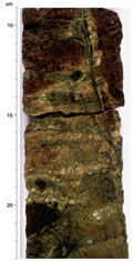
F18. Close-up photograph of interval 183-1139A-53R-2, 51-60 cm.
F19. Close-up photograph of interval 183-1139A-56R-1, 36-41 cm.
F20. Photomicrograph showing domains of flattened wispy clasts.
![]() Figures F1-F20
Figures F1-F20
![]() Figures
F21-F40
Figures
F21-F40
![]() Figures
F41-F60
Figures
F41-F60
![]() Figures
F61-F80
Figures
F61-F80
![]() Figures
F81-F100
Figures
F81-F100
![]() Tables
T1-T19
Tables
T1-T19