![]() Figures F1-F22
Figures F1-F22
![]() Tables
T1-T2
Tables
T1-T2
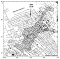
F1. Location map of seismic station coverage in the northwest Pacific.

F2. Location of Site 1179 relative to circum-Pacific and other earthquakes.

F3. Leg 191 site locations and magnetic lineations in the northwest Pacific.

F4. Site 1179 location relative to magnetic lineations in the northwest Pacific.
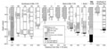
F5. Comparison of stratigraphic columns at Site 1179 and other boreholes in the northwest Pacific.
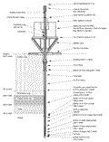
F6. Schematic of the WP-2 seismic borehole observatory.

F7. MEG-191 system controller attached to the riser/hanger assembly prior to installation.

F8. Power access terminal battery frame being lowered through the moonpool.

F9. Snapshot showing the PAT landed properly on top of the Hole 1179E reentry cone.

F10. Schematic of the borehole seismic observatory installation in Hole 1179E.
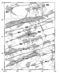
F11. Magnetic lineations in the vicinity of Site 1179.
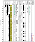
F12. Lithostratigraphic summary column for Site 1179.
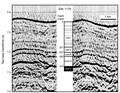
F13. Comparison of the site survey, the lithostratigraphic column at Site 1179, and lithostratigraphic boundary depths.
F14. Clay- and radiolarian-bearing diatom ooze of Unit I.
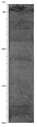
F15. Clay-rich diatom-bearing radiolarian ooze of Unit II.
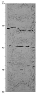
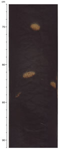
F16. Brown pelagic clay found in Unit III.
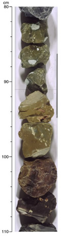
F17. Chert fragments recovered from Unit IV.
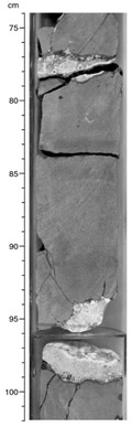
F18. Basalt from Unit V.
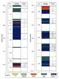
F19. Summary of igneous units in the basaltic basement section.
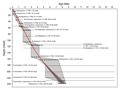
F20. Age-depth curve for Site 1179 developed from biostratigraphic data.
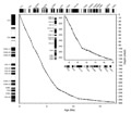
F21. Age-depth curve for Site 1179 from interpretations of paleomagnetic data.
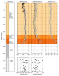
F22. Summary figure showing velocity, density, and porosity vs. depth at Site 1179.
T1. Coring summary.
T2. Extended coring summary.