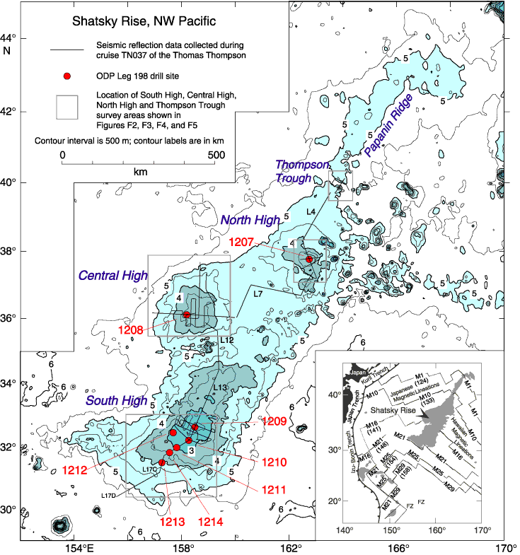
Figure F1. Bathymetric map of Shatsky Rise showing the locations of seismic reflection profiles collected for this study (solid lines). Gray rectangles show the outline of study areas shown in Figures F2, F3, F4, and F5. Bathymetric map is from Sager et al. (1999). L4, L7, L12, and L13 show the locations of seismic profiles not shown in Figures F2, F3, F4, and F5. ODP Leg 198 drill sites (1207-1214) are shown in red. Inset: Location of Shatsky Rise in the northwest Pacific showing a simplified magnetic lineation interpretation of Nakanishi et al. (1999). Numbers in parentheses below "M" anomaly labels indicate age in Ma (based on the timescale of Gradstein et al., 1994).