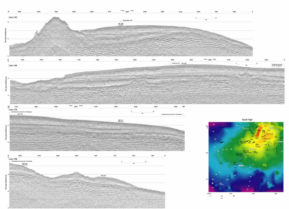
Figure F8. Seismic lines (14A, 14C, 17A, and 17B) collected over the South High showing the locations of Sites 1209, 1210, 1211, 1213, and 1214 (Site 1212 is not located on one of our seismic lines). Bathymetric map shows the locations of all the South High seismic lines collected. Seismic lines not displayed in this figure (14B, 14D, 15, 16, 17C, and 17D) are shown in Figures F13 and F14.
Click
here or on image to see larger
image. This figure is available in an oversized
format.