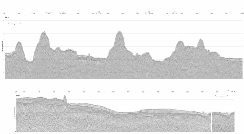
Figure F9. Top: Seismic line 3 collected over the Thompson Trough on the Papanin Ridge. Location of the seismic line is shown in Figure F5. Bottom: Seismic line 4 collected during the transit from the Thompson Trough to the North High survey area. The location of the seismic profile is shown in Figure F1. C/C = change in ship's heading.
Click
here or on image to see larger
image. This figure is available in an oversized
format.