![]() Figures F1-F20
Figures F1-F20
![]() Figures F21-F22
Figures F21-F22
![]() Tables T1-T12
Tables T1-T12
F1. Bathymetric map of Leg 205 and 170 drill sites.
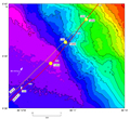
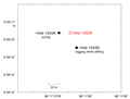
F2. Location of Site 1255.
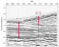
F3. Multichannel seismic profile BGR 99-44.
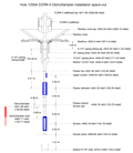
F4. Hole 1255A borehole installation.
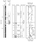
F5. Stratigraphic log, Site 1255.
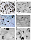
F6. Fine-grained sediments with a variable proportion of clay.
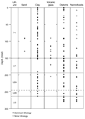
F7. Smear slide data, Sites 1255 and 1043.
F8. Sediments recovered at Site 1255.
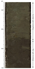
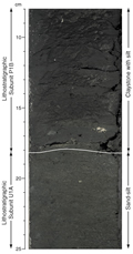
F9. Color contrast between claystone with silt and clay-rich diatom-bearing sediment.
F10. A redeposited conglomeratic layer.
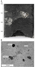
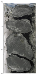
F11. Cobble of lithified limestone.
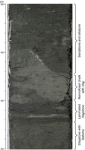
F12. Lithologic variation below the Unit T1/Subunit U1A lithostratigraphic boundary.
F13. Cobbles of lithified siltstone.
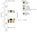
F14. Structural and lithologic summary.
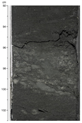
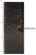
F15. Base of the décollement zone and Unit T1/Subunit U1A lithologic boundary.
F16. Porosity, bulk density, and corrected GRA and moisture and density bulk densities.
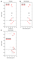
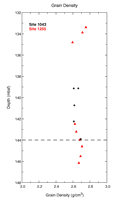
F17. Grain densities.
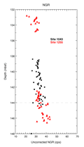
F18. Uncorrected MST NGR measurements.
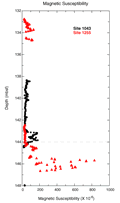
F19. MST volumetric magnetic susceptibility.
F20. Magnetic polarity changes of archive-half cores after 40-mT demagnetization.
![]() Figures F1-F20
Figures F1-F20
![]() Figures F21-F22
Figures F21-F22
![]() Tables T1-T12
Tables T1-T12