![]() Figures F1-F20
Figures F1-F20
![]() Figures
F21-F33
Figures
F21-F33
![]() Tables
T1-T2
Tables
T1-T2
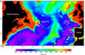
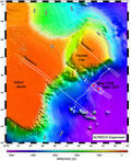
F1. Bathymetric map of the conjugate Newfoundland and Iberia margins.
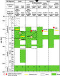
F2. Rift events in the Newfoundland–Iberia rift.
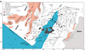
F3. Anomaly M0 reconstruction.
F4. Interpretation of conjugate seismic reflection sections.
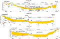
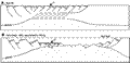
F5. Three transects of the SCREECH survey.
F6. SCREECH survey along transect 2.
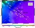
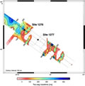
F7. Bathymetry of the Newfoundland margin.
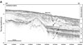
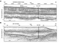
F8. SCREECH line 2MCS in three sections.
F9. Simplified interpretation of SCREECH line 2MCS.
![]()
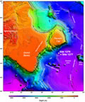
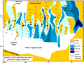
F10. Isopach map of the U–basement interval.
F11. Time-migrated profiles.
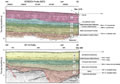
F12. Seismic sequences and lithologic breaks and age.
F13. Isopach map of acoustic Unit 4.
F14. Schematic models of rift development.
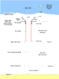
F15. Proposed drilling and casing plan, Site 1276.
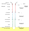
F16. Site 1276 installation and cored intervals.
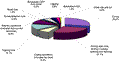
F17. Breakdown of operational activities.
F18. Lithostratigraphic units at Site 1276.
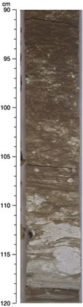
F19. Poorly sorted muddy sandstone.
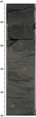
F20. Massive, poorly sorted grainstone with carbonate granules.
![]() Figures F1-F20
Figures F1-F20
![]() Figures
F21-F33
Figures
F21-F33
![]() Tables
T1-T2
Tables
T1-T2