![]() Figures F1-F12
Figures F1-F12
![]() Tables T1-T11
Tables T1-T11
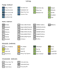
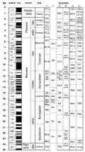
F1. Core description forms symbol key.
F2. Classification of limestones according to depositional texture.
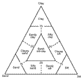
F3. Grain-size classification of terrigenous sediments.
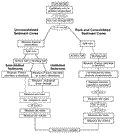
F4. Classification scheme used for siliciclastic sediments and rocks.
F5. Chronostratigraphic units correlated with planktonic foraminifer and calcareous nannofossil zonations and the GPTS.
F6. The zonal schemes of Martini (1971) and Bukry and Okada (1980).
F7. The events that define the zonal scheme of Jenkins (1985, 1993).
F8. Color reflectance records from Holes 1126B and 1126C.

F9. Physical properties measurements.
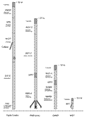
F10. Configurations of tool strings.
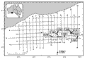
F11. Map of the western Great Australian Bight showing Leg 182 drill sites.
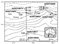
F12. Map showing Leg 182 drill sites relative to AGSO169.
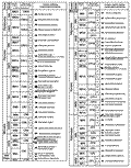
T1. Lithologic description of granular sediments and rocks.
T2. Lithologic description of nonpelagic calcareous sediments and rocks.
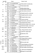
T3. Ages of calcareous nannofossil datum levels, Leg 182.
T4. Ages of planktonic foraminifer datum levels, Leg 182.
T5. Splicer data output file.
T6. Standard deviations for chemical analyses.
T7. Sampling intervals for physical properties measurements.
T8. Logging tools.
T9. Logging tool and measurement acronyms, and units of measurement.
T10. LDEO-TAP tool specifications.
T11. Acquisition parameters used to establish regional seismic stratigraphy in the western Great Australian Bight.